Mykonos
From Wikipedia, the free encyclopedia
For other uses, see Mykonos (disambiguation).
Not to be confused with Mykines.
| Mykonos Μύκονος | |
|---|---|
| Regional unit | |

Mykonos town
| |
 Mykonos within the South Aegean | |
| Coordinates: 37°27′N 25°21′ECoordinates: 37°27′N 25°21′E | |
| Country | |
| Region | South Aegean |
| Capital | Mykonos (town) |
| Area | |
| • Total | 105.2 km2 (40.6 sq mi) |
| Population (2011) | |
| • Total | 10,134 |
| • Density | 96/km2 (250/sq mi) |
| Time zone | EET (UTC+2) |
| • Summer (DST) | EEST (UTC+3) |
| Postal codes | 846 00 |
| Area codes | 22890 |
| Car plates | EM |
| Website | www |
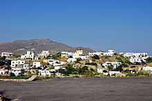
Mykonos (/ˈmɪkəˌnɒs/, /ˈmɪkəˌnoʊs/;[1] Greek: Μύκονος [ˈmikonos]) is a Greek island, part of the Cyclades, lying between Tinos,Syros, Paros and Naxos. The island spans an area of 85.5 square kilometres (33.0 sq mi) and rises to an elevation of 341 metres (1,119 feet) at its highest point. There are 10,134 inhabitants (2011 census), most of whom live in the largest town, Mykonos, which lies on the west coast. The town is also known as Chora (i.e. the Town in Greek, following the common practice in Greece when the name of the island itself is the same as the name of the principal town).
Geography[edit]
The island spans an area of 85.5 square kilometres (33.0 sq mi) and rises to an elevation of 341 metres (1,119 feet) at its highest point. It is situated 150 kilometres (93 miles) east of Athens in the Aegean Sea. The island features no rivers, but numerous seasonal streams two of which have been converted into reservoirs.
The island is composed mostly of granite and the terrain is very rocky with many areas eroded by the strong winds. High quality clay andbaryte, which is a mineral used as a lubricant in oil drilling, were mined on the eastern side of Mykonos until the late 1900s.
It produces 4,500 cubic metres (160,000 cu ft) of water daily, by reverse osmosis of sea water in order to help meet the needs of its population and visitors.[11]
Climate[edit]
The sun shines for up to 300 days a year. It rains between February and March. This arid climate produces sparse vegetation.[citation needed] Vegetation grows around the beginning of winter and ends in mid-summer.[13]
Although temperatures can rise as high as 40 °C (104 °F) in the summer months, average temperatures are around 28 °C (82 °F). In the winter, average temperatures are 15 °C (59 °F).[citation needed]
There are two seasonal winds in Mykonos. The one in winter arrives from the south and is sometimes accompanied by electrical storms. The Sirocco, a famous southern wind, carries sands from the deserts that border the Mediterranean.[citation needed] In the summer a cooling wind comes from the north, the Meltemi, during July and August.
Villages[edit]
There are ten villages:
- Agios Ioannis
- Agios Stefanos
- Ano Mera
- Ftelia
- Kalafati
- Mykonos or Chora
- Ornos
- Platys Gialos
- Psarrou
Gallery[edit]
Transportation[edit]
Mykonos Airport is located 4 kilometres (2.5 mi) southeast of the town of Mykonos and it is served by international flights during summer. The flight from Athens to Mykonos is 25 minutes.[31]Mykonos is also accessible by boat and ferries. High speed vessels travel there daily from the surrounding islands and from Athens.[32]Taxis, buses or boats are available for transportation. There are three main bus depots in Mykonos. The northern one is situated behind Remezzo Club above the old Port and provides regular service to Ano Mera, Elia and Kalafatis. A few hundred meters below, at the Old Port, lays another Depot focusing on the northern destinations of Tourlos (New Port) and Agios Stefanos. The southern Bus Depot is at the town "entrance", called Fabrika and it provides regular service to Ornos, Agios Yannis, Plati Gialos, Psarou, Paraga, and Paradise Beach. Small boats travel to and from the many beaches.[33] Tour boats go regularly to the nearby island of Delos.[34]


Δεν υπάρχουν σχόλια:
Δημοσίευση σχολίου